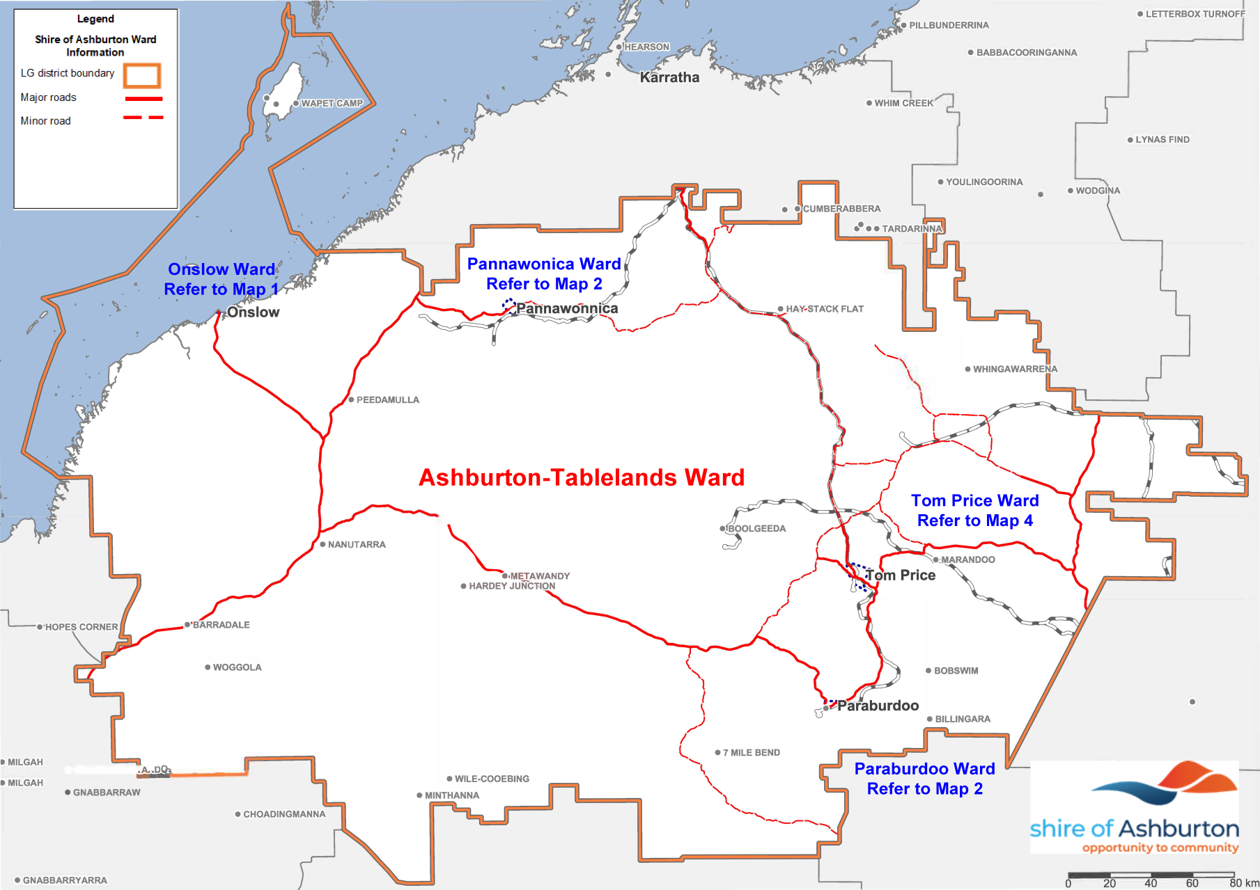
Wards
The Shire of Ashburton district covers an area of 105,674 square kilometres. Following a recent statutory review, an Order published in the Government Gazette on 30 June 2023 reduced the number of Wards in the district to 5, effective from 1 July 2023.
The districts wards are:
- Ashburton-Tablelands Ward
- Onslow Ward
- Pannawonica Ward
- Paraburdoo Ward
- Tom Price Ward
The Ashburton-Tablelands ward covers the pastoral and mining regions of the district. The remaining wards are based around the major population centres. The largest town, Tom Price is the location of the Shire administration centre.
This map details the district generally and outlines the Ashburton -Tablelands Ward. Maps detailing the districts other wards can be found below.
Download map of the Shire of Ashburton wards
For reference: Paraburdoo is about 80kms south of Tom Price. Pannawonica is 330kms north west of Tom Price and Onslow is 380kms west of Tom Price in lineal distance. The distances by road however are far in excess of these figures.