History and Heritage
The Shire of Ashburton acknowledges the first custodians of this region, the richness of their culture and the responsibility of all Australians to respect Aboriginal heritage.
Tom Price: Eastern Guruma
Onslow: Thalanyji
Pannawonica: Kurrama
Paraburdoo: Yinhawangka
We respect and honour the traditional owners, custodians, native land titles and Elders past, present and future. We acknowledge the stories, traditions and living cultures of Aboriginal peoples on this land and commit to building a brighter future together.
Our region's history
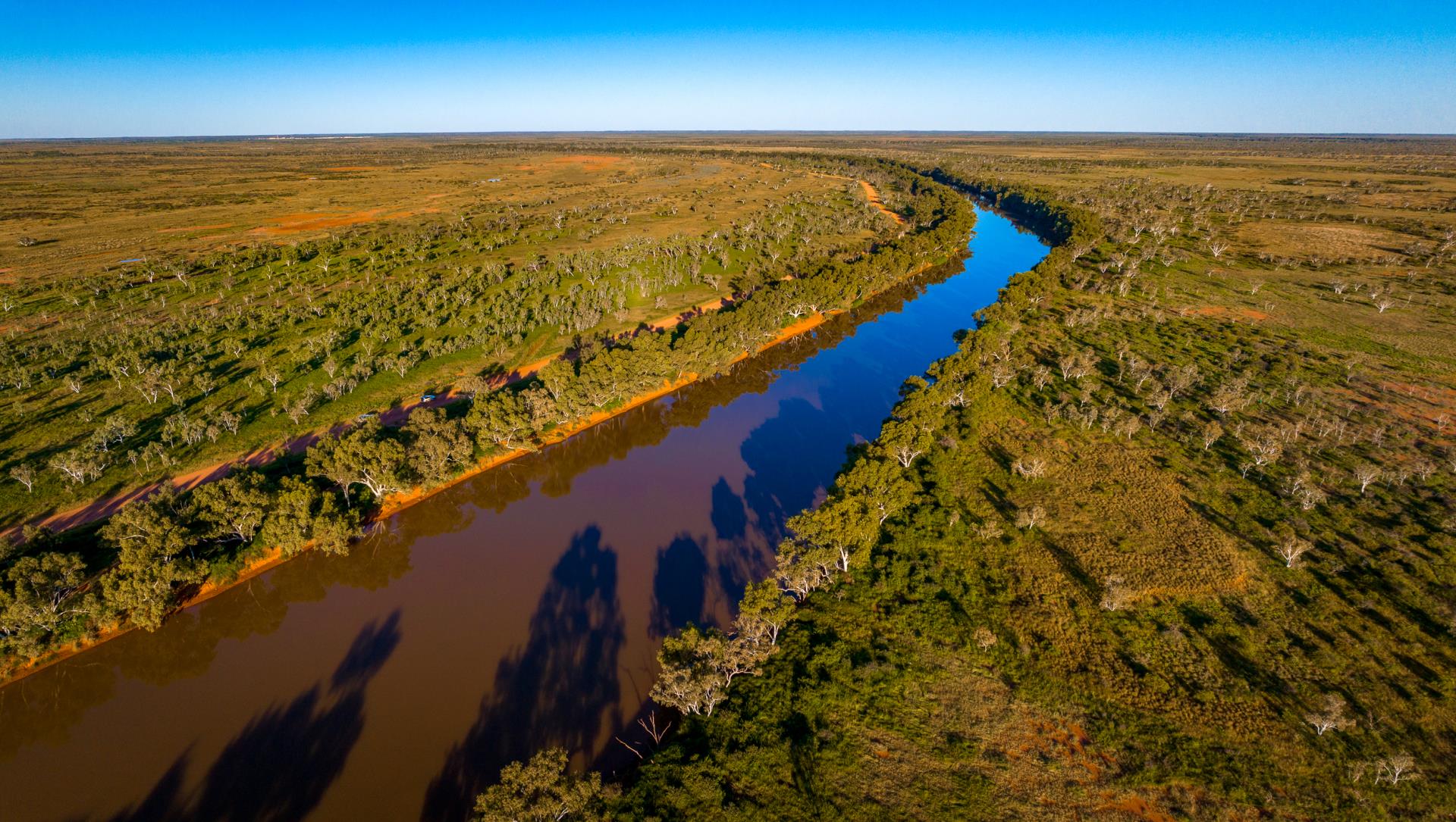
Representing 20% of Western Australia’s land mass, the Pilbara is a vast, diverse region of mountain ranges, deserts, plains and numerous offshore islands. While at its southern edge the Pilbara is located approximately 1200km north of Perth, the region extends over an area of 507,896km2 from the Indian Ocean in the west, north to the Kimberley and across the Great Sandy Desert to the border of the Northern Territory in the east.
The region’s history dates back as far as 40,000 years with evidence of the Aboriginal population living off the land. Over 700 historic Aboriginal archaeological sites have been found in the Pilbara, and over 10,000 rock engravings. The region, and most notably on the Burrup Peninsula which is recognised as one of the richest petroglyph sites recorded, is a major rock engraving area and features a greater number and variety of figures than anywhere else in Australia, many dating back 30,000 years or more.
Aboriginal people have inhabited the Pilbara area for tens of thousands of years and continue to share a deep and meaningful connection to the lands. They lived predominantly alone in this area until around 1861 when European explorers first came to settle in the Pilbara. Early European settlement occurred at Roebourne and the port of Cossack.
Early industry was largely pastoral, gold mining and pearling. Until the advent of iron ore mining in the 1960s, the only towns were Onslow, Roebourne, Point Samson (having replaced Cossack as the port servicing Roebourne), Wittenoom, Marble Bar, Nullagine and Port Hedland.
For an insight into the world’s oldest continuous living culture, visitors are invited to travel the Warlu Way; a 2,500km stretch of rich Australian outback. This fascinating journey transports you back in time to when a powerful, mystical serpent emerged from within the sea and travelled through the pulsing red heart of the outback, forming magnificent waterways as he moved. With inspiration and guidance from the interpretive signage along the drive – created in close collaboration with the traditional owners – you’ll learn other creation stories and experience the landscape from a totally new perspective.
Both entertaining and educational, the significant connection between the natural wonders of this country and the local Aboriginal culture is gently revealed. Beginning on the shores of the world’s largest fringing reef, Ningaloo, the Warlu Way leads you nearly 2,500 kilometres to discover the stories, histories, and art styles of the Aboriginal people of Northwest Australia.
A magical insight into the first people to step foot on Pilbara lands, this once-in-a-lifetime journey shines a light on the Indigenous people’s unbreakable relationship and binding bonds to the land. It acknowledges the ongoing connection that local Aboriginal groups have to this country. As a visitor, please travel thoughtfully and respect the wishes of your hosts.
The Pilbara
The Pilbara region, home to over 60,000 people, encompasses approximately one fifth of Western Australia’s total land mass.
As an outcome of both the natural resources residing within the region and its proximity to the Asian Pacific, the Pilbara is a substantial economic contributor at both a state and national level. The Pilbara region’s growth projection reflects the economic contribution of the region through iron ore, oil and gas, and other rare earth minerals from many resource projects located across the Pilbara.
History of the Shire
The West Pilbara Shire Council was formed in 1972 by an amalgamation of the Shires of Ashburton and Tableland. The Council's first meeting convened at Onslow on June 8, 1972.
The name "Shire of West Pilbara" was later changed to "Shire of Ashburton" on December 18, 1987, one hundred years after the establishment of the former Ashburton Road Board.
The name was changed to provide more identity to our particular region and to discriminate from the Karratha region, which is also referred to as the "West Pilbara".
The Ashburton River runs through the lower portion of the region, and the Shire includes four established townsites: Tom Price, Paraburdoo, Onslow and Pannawonica.
It was decided to move the administration office from Onslow to the more centrally located town of Tom Price in January 1990, when the Shire's administration office was officially opened in Poinciana Street. Subsidiary offices are located in Onslow and Paraburdoo, and while Pannawonica does not have a sub-office of the Shire, the Pannawonica Library can respond to most enquiries.
In 2022, celebratory events were held across the Shire to mark 50 years of the Shire of Ashburton.
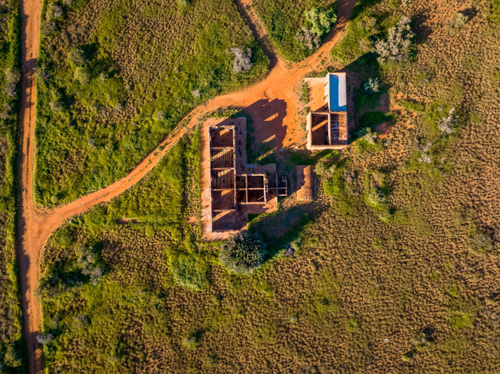
Heritage
The Shire of Ashburton has a rich and varied heritage, which is present in many forms such as landmarks, buildings, objects, cultural landscapes and the stories and traditions associated with them.
This heritage is an important asset as it contributes to the cultural identity of the community; it provides a link to the past allowing us to understand the history of where we have come from; and contributes to the richness of the environment.
The identification and protection of local heritage assets is required under State legislation to ensure that these places are appropriately managed for the benefit of future generations.
In 2016, the Shire commenced a review of its Municipal Heritage Inventory (now known as a Local Government Heritage Inventory or LGHI) to meet statutory obligations and to ensure information relating to places of heritage value in the district were up-to-date and thorough.
View our Municipal Heritage Inventory.
Old Onslow Cemetery Conservation Management Plan 2018